
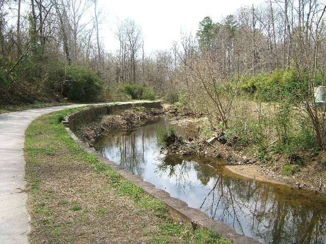

Think back to the last time you were on a public trail: what did you see along the path? Apart from trees and the occasional informational sign, you might have noticed water pipes, manmade channels, or sewer covers nearby. Do planned greenways, or public trails, just happen to intersect these service lines? My own casual observation walking along greenways in Chapel Hill, NC led me to think more about why they might be located along utility service lines and the possible implications for city planning. As it turns out, locating trails near existing or planned service lines can be advantageous for municipalities, and is consistent with city planning goals.
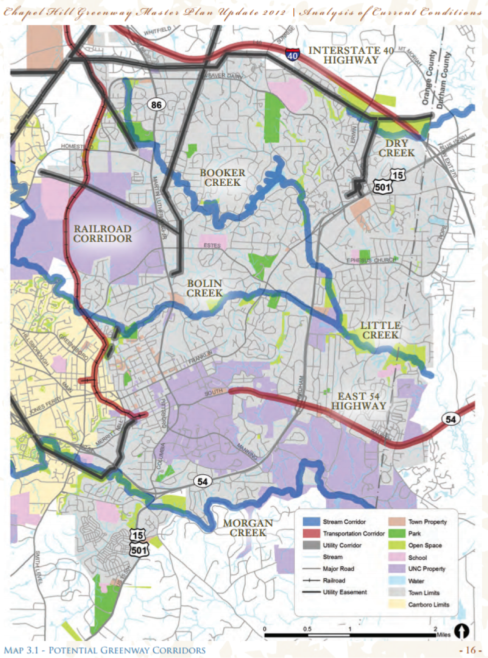
The Town of Chapel Hill currently has over 13.4 miles of paved or natural surface greenway trails and has located the vast majority of their trails on sewer easements. Pairing trails with sewer lines has been a necessity for Chapel Hill, since undeveloped areas in town tend to be locations where sewer lines are already in place. Bill Webster, Chapel Hill’s Greenway Planner, stated that the main advantage of locating trails along established sewer lines is environmental protection. Placing the trails along corridors that have already been cleared for sewer lines means that fewer trees need to be cleared for greenways. Since environmental conservation is one of three foundational goals of the Chapel Hill Greenway Master Plan, the construction of greenways near sewer lines is an important component of the town’s greenway planning process.
In terms of financing greenway projects, building along sewer lines can either increase or decrease costs, according to Bill Webster. On one hand, projects can cost more when Chapel Hill has to accommodate maintenance needs of the sewer utility (such as large construction trucks that need to pass through) or when they have to alter existing sewer infrastructure to accommodate a trail. On the other hand, trail construction costs can be lower along sewer lines since the land is already partially developed and accessible. For natural gas or power transmission lines, the town has run into difficulties because gas and electric utility easements are more likely than sewer lines to cross over land of many different private property owners and to run across more varied topography. Nevertheless, Chapel Hill has found success working with the Orange County Water and Sewer Authority (OWASA) to construct trails on sewer easements.
Another example close to home is the recent decision made by Orange Water and Sewer Authority (OWASA) to allow a section of their land to be used for part of the North Carolina Mountain-to-Sea trail. The Mountain-to-Sea trail covers over 1150 miles of hiking trails that cross the state, from the Great Smoky Mountains to the Outer Banks. In August of 2016, OWASA approved the use of land near Cane Creek Reservoir to be developed for use as a branch of the trail. The land does not have sewer or water lines along it, but is owned by OWASA for protection of the reservoir.
Throughout the public feedback session, community members voiced concerns about the possibility that the trail would bring increased activity and crime to the rural area. Such concerns suggest broader implications for placing trails on utility service land. One of OWASA’s main conditions for the use of their land for the trail was to “mitigate risks associated with hikers using OWASA property.” Of course, in cases where trails are built along sewer lines, there are safety concerns when the public is walking or biking in close proximity to sewer infrastructure if pipes break or need maintenance. However, OWASA also highlights the main advantage of the agreement: increasing public access to the scenic area around Cane Creek. Sewer lines tend to be located along bodies of water or creeks and run between neighborhoods or developments that have a need for transportation connections. These factors mean that the sewer line corridors also check many of the boxes for optimal locations of trails: scenic, reasonable topographic changes, and accessible to the public for alternative transportation.
Ruth Rouse, Planning and Development Manager with OWASA, made comments similar to Bill Webster (with the Town of Chapel Hill) about the fairly neutral financial impacts of building trails along sewer and water infrastructure lines. According to Rouse, OWASA and the Town of Chapel Hill work closely together to make sure that the greenway plans are compatible with OWASA’s land and infrastructure. Furthermore, Rouse pointed out that cities like Raleigh, with utility service and Parks and Recreation departments operating under the same municipal government, could allow for programs that are financially advantageous for both departments. In contrast, the Town of Chapel Hill (municipal) and OWASA (county-level) have separate priorities and finances, which makes financial benefits for either party more difficult to achieve when collaborating on greenway projects.
While some concerns need to be actively mitigated, coupling utility service lines with trails that provide recreation and transportation opportunities for the public is often consistent with the needs of recreational planning departments. The successful relationship between the Chapel Hill Parks and Recreation department and OWASA has simplified the process of planning and constructing greenways, which are in high public demand. I hope to see a continued effort of such intergovernmental collaboration and multi-use projects that balance the priorities of different public services and support healthier communities. Hopefully this has reminded you to check out the greenways and public trails near your community–let me know what you find!
Caitlin Seyfried is a student at The University of North Carolina at Chapel Hill studying Environmental Science. Caitlin currently works as research assistant on EFC water and wastewater survey projects.
Cover image source: http://www.parkgeek.com/parkdetails.cfm?parkid=235

Leave a Reply